Superior Hardware: The Foundation of Our Performance
At Fair Lifts Unmanned Services, we recognize that true professional mastery is only as effective as the instruments used to execute it. Moultrie stands as a cornerstone of Georgia’s agricultural and industrial corridor, necessitating technology that thrives in high-heat, high-humidity environments while maintaining surgical precision. We operate far beyond simple drone ownership; we manage a sophisticated, mission-ready fleet that undergoes annual modernization to keep our clients at the absolute cutting edge. Our systems are specifically configured to navigate the unique geography of the Coastal Plain—from the expansive cotton and peanut fields to the dense pine plantations that characterize the Colquitt County economy.
Partnering with Fair Lifts allows local enterprises to bypass the inherent risks of capital investment. The lifecycle of high-end drone technology is incredibly short, with hardware often reaching obsolescence within two years. By leveraging our specialized services, South Georgia businesses access a multi-million dollar inventory of aerial assets without the burden of upfront costs, complex maintenance schedules, or specialized pilot training. Whether you require a high-resolution survey of a 5,000-acre timber tract or a detailed thermal inspection of industrial infrastructure, we guarantee execution using the most secure and capable systems available on the global market.
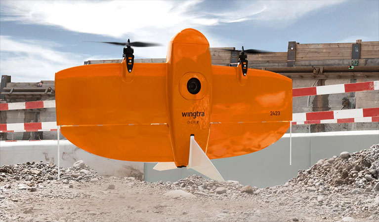
WingtraOne Gen II: Redefining Mapping Efficiency
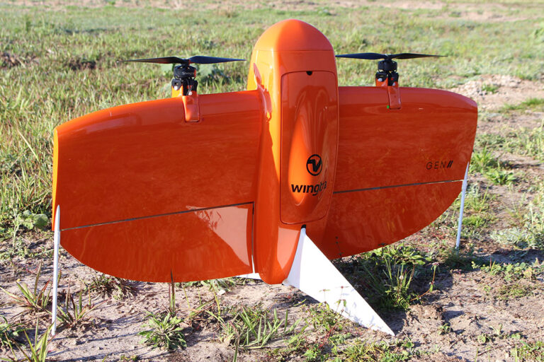
When the mission calls for wide-area photogrammetry and topographic mapping, the WingtraOne Gen II is our primary asset. In a region as geographically vast as the Coastal Plain, speed and coverage are paramount to a project's bottom line. The WingtraOne is a sophisticated VTOL (Vertical Take-Off and Landing) fixed-wing aircraft. This enables us to launch and recover from confined spaces—like narrow logging trails or rural field margins—without the need for a runway, all while delivering the high-speed, long-range performance of a traditional airplane. A single deployment can capture over 700 acres, providing ten times the coverage of standard multi-rotor drones.
We never trade speed for data integrity. Our WingtraOne Gen II units are integrated with high-performance Post-Processed Kinematic (PPK) GNSS technology. When synchronized with our regional Emlid base stations, we provide centimeter-level absolute accuracy, drastically reducing the need for manual ground control points (GCPs). For Moultrie’s engineers, developers, and land managers, this translates to survey-grade deliverables produced with unprecedented speed, resulting in a metrically perfect digital representation of your land.
XAG P150: The Future of Aerial Crop Care
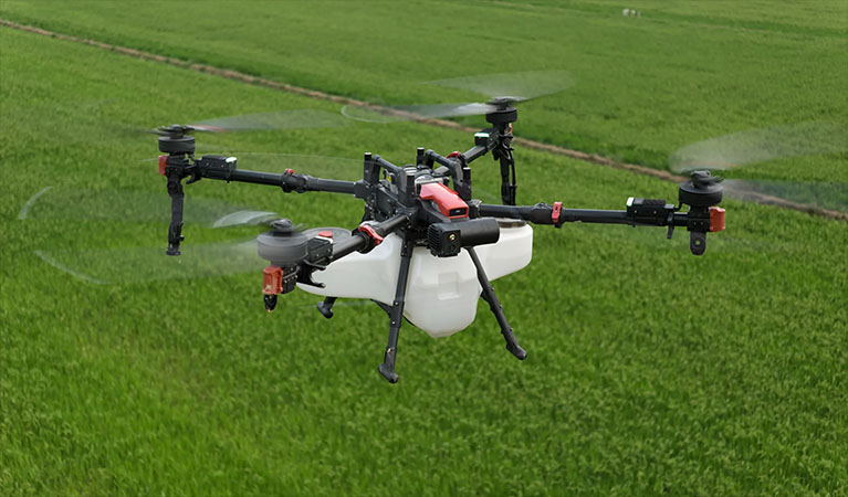
For precision application in the agricultural sector, we utilize the XAG P150—the pinnacle of heavy-lift robotic spraying technology. Given the South Georgia climate, the window for effective fungicide and insecticide application is often narrow. The P150 is engineered for the relentless duty cycles required in local field work, featuring a massive 70-liter payload capacity and advanced centrifugal atomization. Unlike standard nozzles that are prone to clogging and uneven distribution, our system produces a consistent, microscopic droplet size that minimizes drift and ensures optimal chemical utilization.
The true technical advantage of the P150 lies in its aerodynamic design. The powerful downward thrust generated by its rotors creates a massive air vortex. As the drone traverses the crop just above the canopy, this "downwash" physically agitates the foliage, flipping leaves to ensure the spray reaches the undersides and the base of the plant. For Colquitt County’s peanut and cotton producers, this 360-degree saturation is vital for combating deep-seated threats like white mold or aggressive insect infestations. We condense days of intensive ground-rig operations into a few hours of automated, high-precision aerial application.
| UAS Feature | Benefit to Moultrie Farmers |
|---|---|
| Variable Rate Application | Apply chemicals only where needed based on high-resolution map data, reducing input costs. |
| Zero Soil Compaction | Effective spraying immediately after heavy rains when ground rigs would cause permanent soil damage or get stuck. |
| Multispectral Imaging | Identifying "hidden" crop stress and nutrient deficiencies before they are visible to the naked eye. |
| Swarm Technology | Multiple drones working a single field in coordination to cover large regional acreage with maximum efficiency. |
Blue UAS: Enterprise-Grade Data Sovereignty
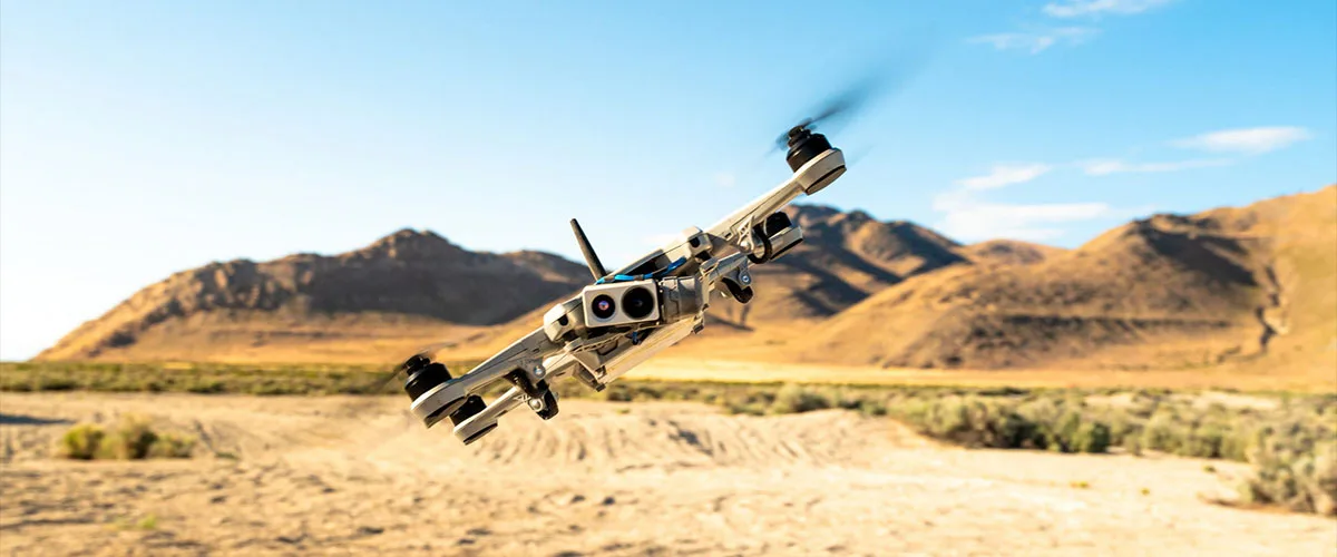
As data security becomes a critical concern for infrastructure and government-linked projects, the origin and integrity of your technology are non-negotiable. Fair Lifts prioritizes the protection of regional data through a fleet centered on Blue UAS Certified platforms. This designation, strictly audited by the U.S. Department of Defense, confirms that our hardware adheres to the highest benchmarks for cybersecurity and supply chain transparency. Whether we are mapping a municipal utility in Moultrie or a regional pipeline, your sensitive geospatial information is encrypted and protected. We eliminate the vulnerabilities inherent in unvetted, consumer-grade drone platforms.
Elite Data Processing: From Raw Imagery to Actionable Intelligence
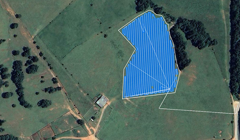
The value of a flight is realized in the data lab. Our workflow concludes with a rigorous processing phase using the industry-leading PIX4D software suite. We employ PIX4Dmatic for massive industrial photogrammetry tasks and PIX4Dfields for high-speed, in-season vegetative health assessments. Our specialists convert terabytes of raw data into high-fidelity orthomosaics, dense 3D point clouds, and multispectral maps. We deliver final products in the CAD, GIS, and Ag-Management formats your team is already using, ensuring that aerial intelligence flows seamlessly into your existing decision-making process.
Integrated Sensor Technology
MAP61 / RGB61
Full-frame Sony sensors delivering ultra-high resolution for microscopic mapping and 3D reconstruction.
Riegl miniVUX LiDAR
High-frequency laser scanning that strips away Georgia's thick timber canopy to reveal the true ground surface with millimeter precision.
MicaSense RedEdge-P
Advanced five-band multispectral and panchromatic imaging for definitive crop health and stress analytics.
Regional Fleet Readiness
Our Moultrie operations center maintains a full inventory of replacement components and backup aircraft. We ensure zero downtime; if a system requires service, a redundant platform is ready for immediate deployment.
Request Technical Brief