
A Technical Blueprint for Superior Unmanned Operations
Welcome to the Moultrie-based gateway for Fair Lifts Unmanned services. We believe that securing a quote for industrial-scale drone operations is more than a financial transaction; it is the beginning of a strategic alliance designed to maximize your harvest, protect your infrastructure, and ensure regulatory compliance. Our project leads are more than just account managers—they are technical specialists based right here in Colquitt County, equipped to evaluate your specific objectives and deliver a precise, data-centric strategy for your land or facility.
The business and farming community here in the "Agricultural Capital of Georgia" operates at a pace dictated by seasonal shifts and regional industrial growth. Whether you are a cotton farmer navigating a tight moisture window, a commercial grower monitoring vegetable health, or a developer requiring high-speed volumetric data for a new project along the Hwy 319 corridor, we recognize that timing is your most valuable asset. Our "Strategy, Action, Analysis" workflow is engineered to guarantee that every mission is streamlined, transparent, and anchored in measurable results.
The Moultrie Operational Workflow
Phase 01: The Localized Assessment
Every high-performance mission is rooted in a thorough discovery phase. For our agricultural partners in the Coastal Plain, this involves a deep dive into your field boundaries, crop varieties (including peanuts, pecans, and cotton), and current pest or disease pressures. For our industrial and engineering clients, we assess site topography, data accuracy needs, and file format specifications. We reject "cookie-cutter" methods. In the South Georgia Coastal Plain, factors like sandy loam drainage, high humidity, and local flight restrictions are pivotal elements we integrate into our pre-flight planning.
Phase 02: Advanced Field Deployment
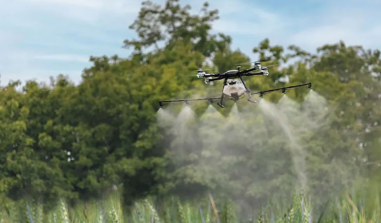
Once the strategy is locked in, our professional flight teams mobilize. By maintaining a local presence in Moultrie, we provide a speed of response that out-of-area operators simply cannot provide. We match the technology to the task, utilizing heavy-payload XAG P150 application drones for spraying or Blue UAS-cleared WingtraOne platforms for high-resolution mapping. Our pilots adhere to rigorous safety standards modeled after manned aviation, ensuring that every acre is covered with centimeter-level precision while respecting the unique thermal conditions and regional protocols of the South.
Phase 03: Data & Intelligence Delivery
A mission is only complete when you have the actionable insights needed to move forward. For aerial application, we provide comprehensive "As-Applied" maps that verify exact coverage and chemical volume. For survey and mapping, we deliver engineering-grade 3D models, LiDAR point clouds, and orthomosaics in the CAD and GIS formats your workflow requires. We conclude every project with a review session to ensure the deliverables align with your operational ROI targets.
Commitment to Regional Growth
Our dedication to the Moultrie area goes far beyond the edge of the field. We are deeply invested in the long-term economic health of Colquitt County. To support this, we provide substantial multi-year and multi-application contract incentives for regional producers and industrial firms. By reserving your service windows early, you ensure priority status during those high-demand summer months when local resources are stretched thin. We serve as your year-round technology wing, managing the fleet and the complex data so you can focus on managing your operation.
Frequently Asked Questions
Project Intake Form
Moultrie Regional Office
Ready to Start Your Project?
Discuss your specific goals in Moultrie with a regional expert. We provide rapid mobilization and precision scoping for every regional client.